Drone Logistic Services
Elevate Your Perspective
Commercial Services

3D Mapping
Basic and High Precision 3d maps can be made of any area for measurement purposes. High Precision lat/lon measurements to +/- 2cm. Thermal maps Available.

Aerial Inspection
Equipped with high resolution 4K and advanced thermal imaging, our aerial inspections deliver precise detail from a elevated view. With 55x hybrid zoom and infrared capabilities, we can capture temperature data, photos, and video of hard to reach places like power lines, water towers, chimneys, roofs, and substations safely and efficiently.
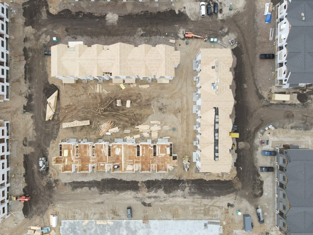
Site Monitoring
Need Live updates of any construction projects? Look no further. With detailed aerial videography added to the picture, you can make sure your projects stay on track with frequent footage and live updates.
All services available in thermal
Using a thermal drone we can locate downed deer and other animals that give off a heat signature . Thermal and zoom available during daylight hours. During night only thermal can be used.

Please contact for pricing
Real Estate and Business

Real Estate Shoot
With precise imaging, we can capture that perfect snapshot of the property you have been looking for that’s sure to draw in attention with stunning aerial videography. Yes I can also fly inside the houses.
Business Reel
1:30 high quality video showcasing the exterior and interior of your business or home. All editing included as well as all raw footage.
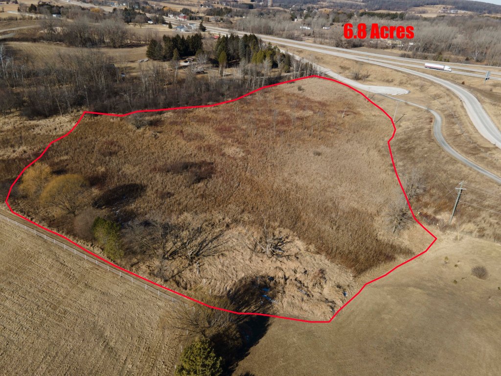
Land Pictures
Simple landscape pictures. Perfect for outlining property lines or for showing the scale of a property.
Event Capture/General Videography

Event Capture
From weddings to brand launches, we capture your event from the sky crisp, cinematic, and uniquely unforgettable. Let your moments shine from a whole new perspective
General Videography
Want a picture of something? Need b-roll for a project? We can get that done for you. Just shoot us an email or text with your details and were sure to get back with all inquires.
About me
Hello, my name is Drake and my story begins with a love for the sky. From flying RC helicopters to piloting a paramotor, my interest shifted into drones. The elegance and journey to capture the perfect shot drew me in. Now as a Part 107 certified pilot, I strive to exceed any expectations and offer a variety of services.

Contact us
I can be reached from 9:00AM-6:00PM (CST) Mon-Fri
(920)-400-2543
Schilderdrake@gmail.com
Check out our socials!
